Cernicalo is a set of Grasshopper components for handling and generating digital terrain models (DTM) and geospatial data in Spain. It includes tools for downloading and processing COG (Cloud Optimized GeoTIFF), transforming between reference systems and generating georeferenced meshes with textures.
Like the bird it is named after, the plugin is designed to move with precision over complex surfaces, turning geospatial data into 3D meshes ready for design and analysis.
⬇️ Download
🖼️ Gallery
✅ Requirements
- Rhino + Grasshopper compatible with user components.
- .NET Framework 4.8.
- GDAL/PROJ installed or embedded in dlls/bin (gdal/csharp, gdal-data, proj9/share).
- Internet connection for external APIs (Earth Search, Overpass, Copernicus) and Catastro/INSPIRE WFS.
⬇️ Quick install
- Copy the assembly (.gha/.dll) to the Grasshopper components folder.
- Place the dlls folder with GDAL/PROJ libraries next to the assembly, or adjust detection in GdalEnvironment.
- Open Grasshopper: the components appear under the Ibice category.
🧩 Components by subgroup
🗺️ Raster To Mesh — Terrain meshes from COG/GeoTIFF
COGtoMesh — Builds a DTM mesh by sampling a COG. Inputs: COG path, step, Z scale. Outputs: Mesh, Info, Header.
CropCOGtoMesh — Like COGtoMesh but crops by an ETRS89 bbox before building the mesh.
PNOAToSup — Crops a PNOA COG in ETRS89 and creates a quad surface with texture coordinates; generates temporary TIFF/PNG and a Material.
TerrenoCompleto — Combines DTM and orthophoto (two COGs) into a 3D mesh textured with orthophoto colours.
🛰️ IGN To Mesh — IGN WCS/WMS download and mesh generation
MDT_IGN — Downloads DTM from IGN WCS (IDEe) for the selected EPSG zone and builds GeoTIFF + mesh. Huso/EPSG options in the context menu.
ORTOFOTO_IGN — Downloads PNOA/IGN orthophotos via WMS and creates a textured mesh/surface.
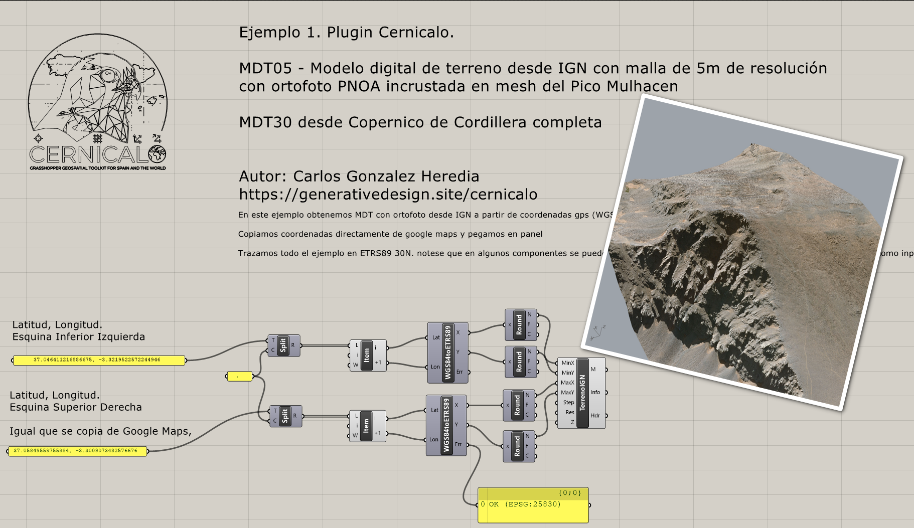
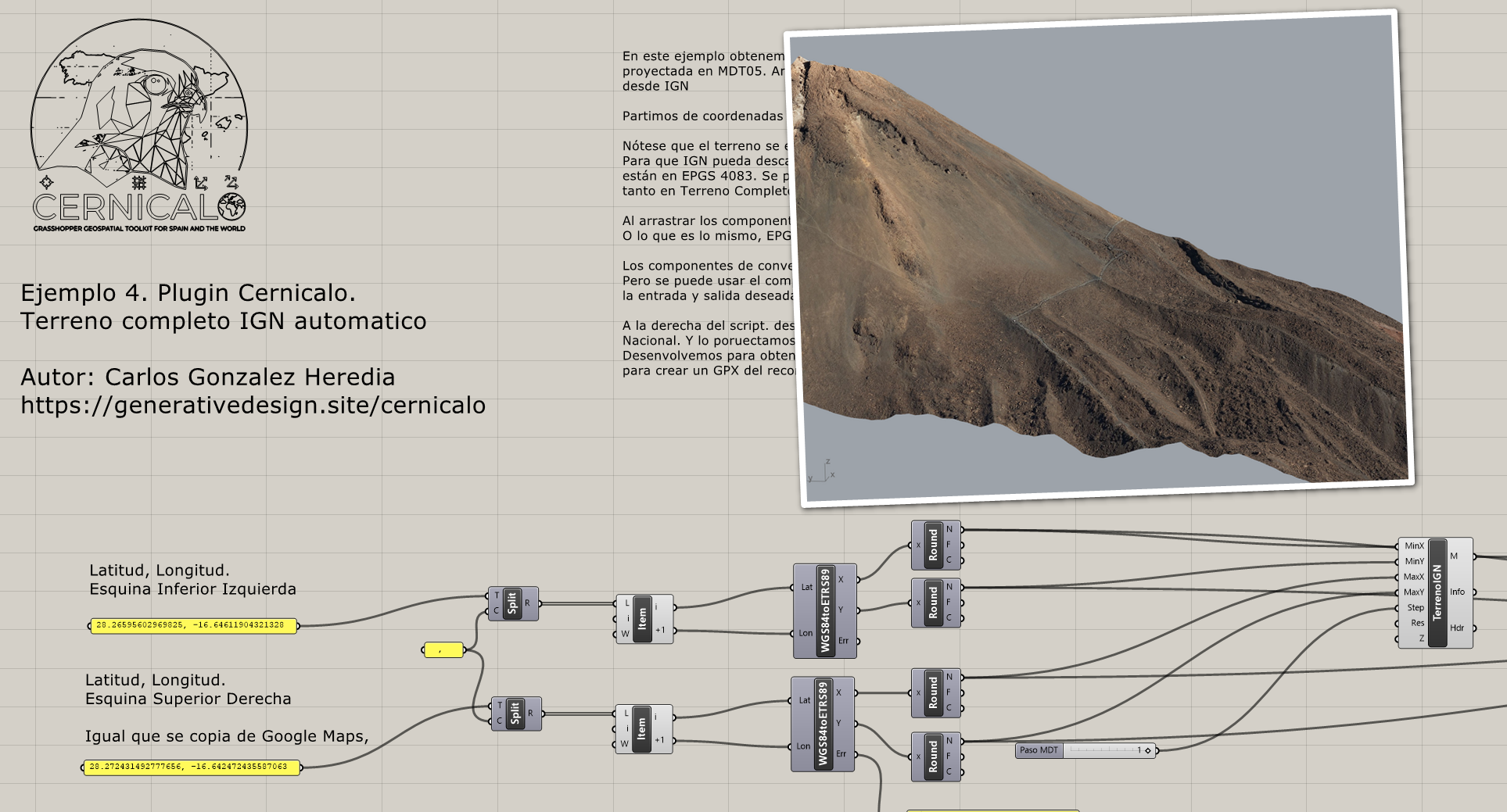
TerrenoCompleto_IGN — Combines DTM (IGN WCS) and orthophoto (IGN WMS), cropped, into a textured 3D mesh.
MDS_IGN — IGN service related component.
🏘️ Catastro / SCN — INSPIRE/SCN data by BBOX
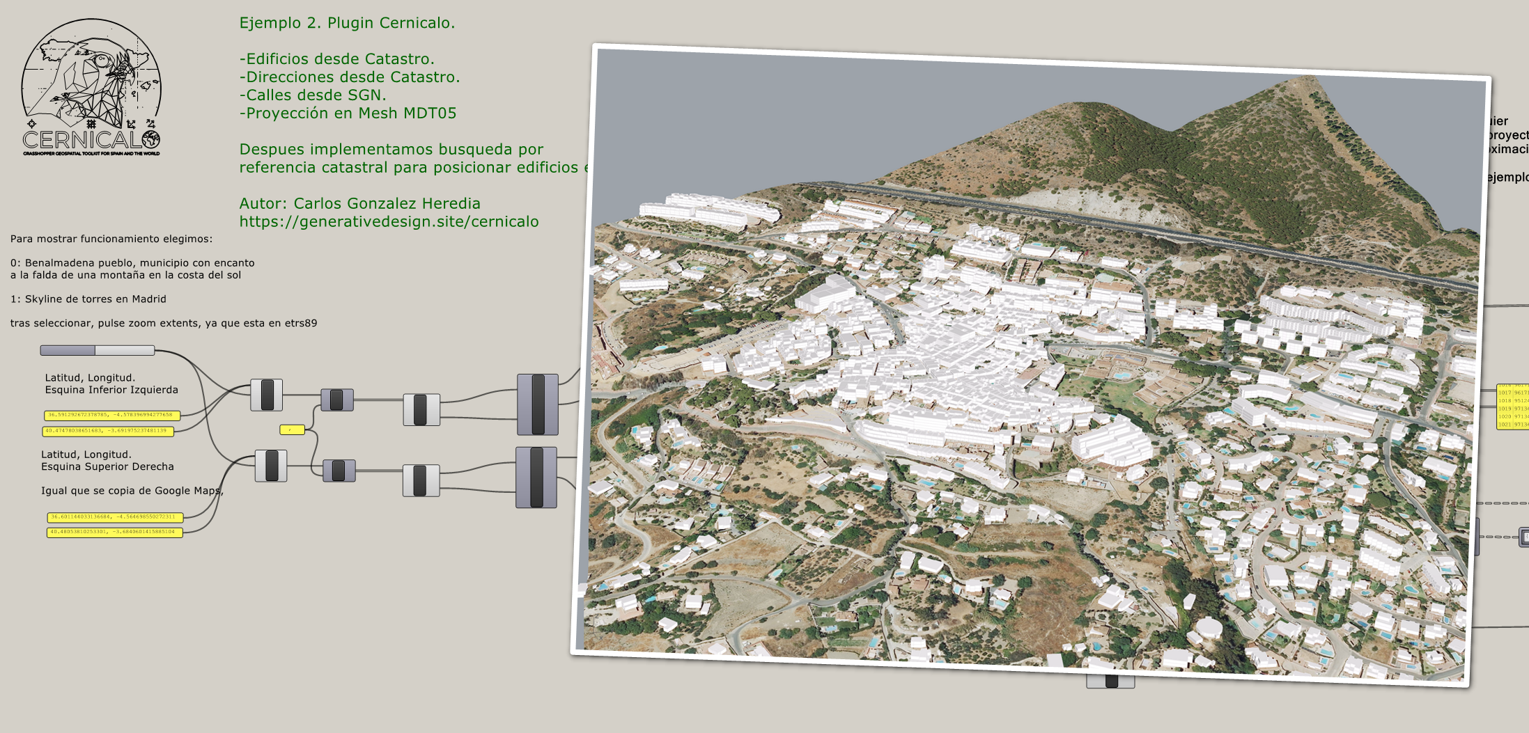
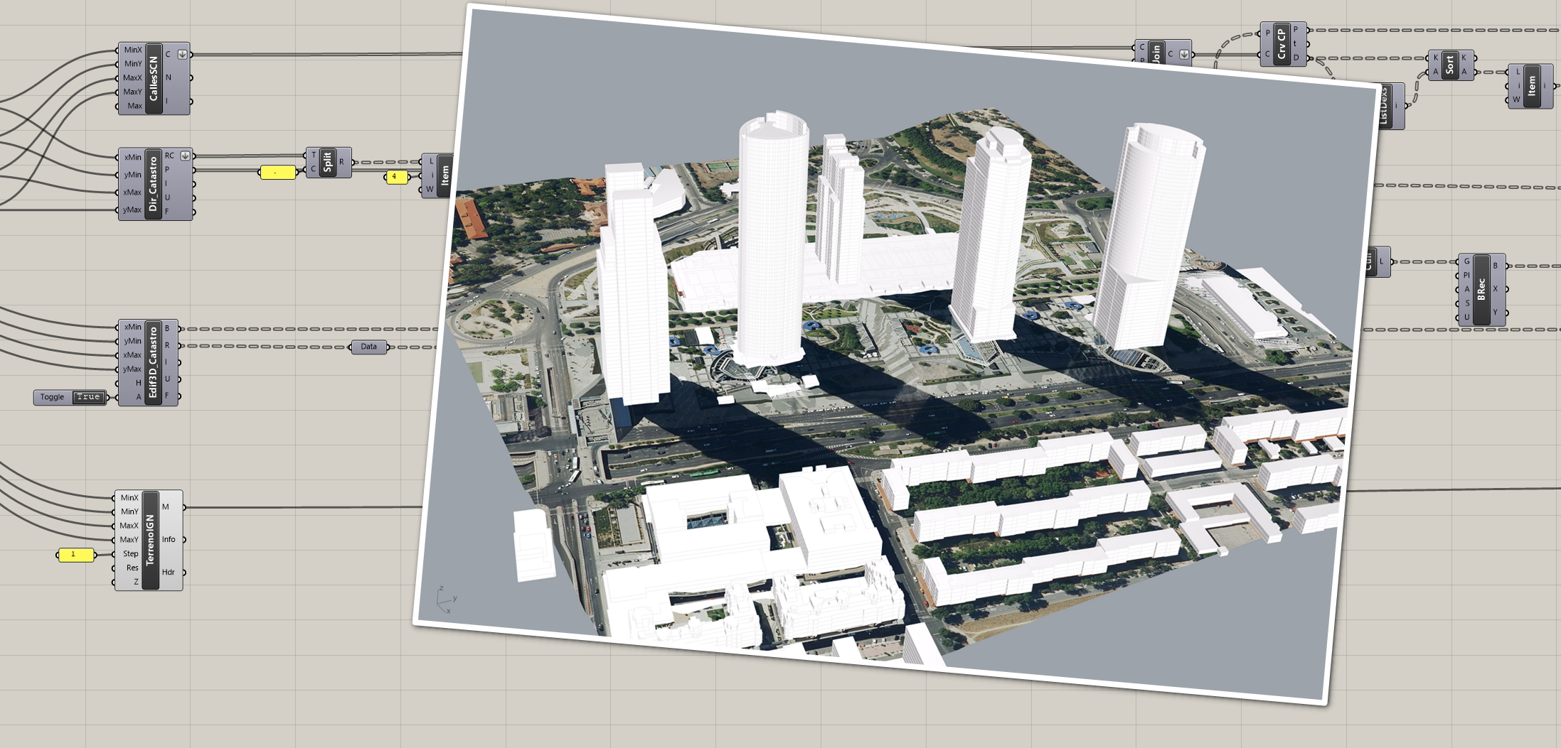
Edif3D_Catastro — Downloads BU.BUILDINGPART, extrudes by storeys (up/down) and returns Breps + summary.
Edif2D_Catastro — Downloads BU.BUILDING and returns 2D footprints (closed curves) + attributes.
Dir_Catastro — Downloads ad:address and returns cadastral reference + point (X,Y,0).
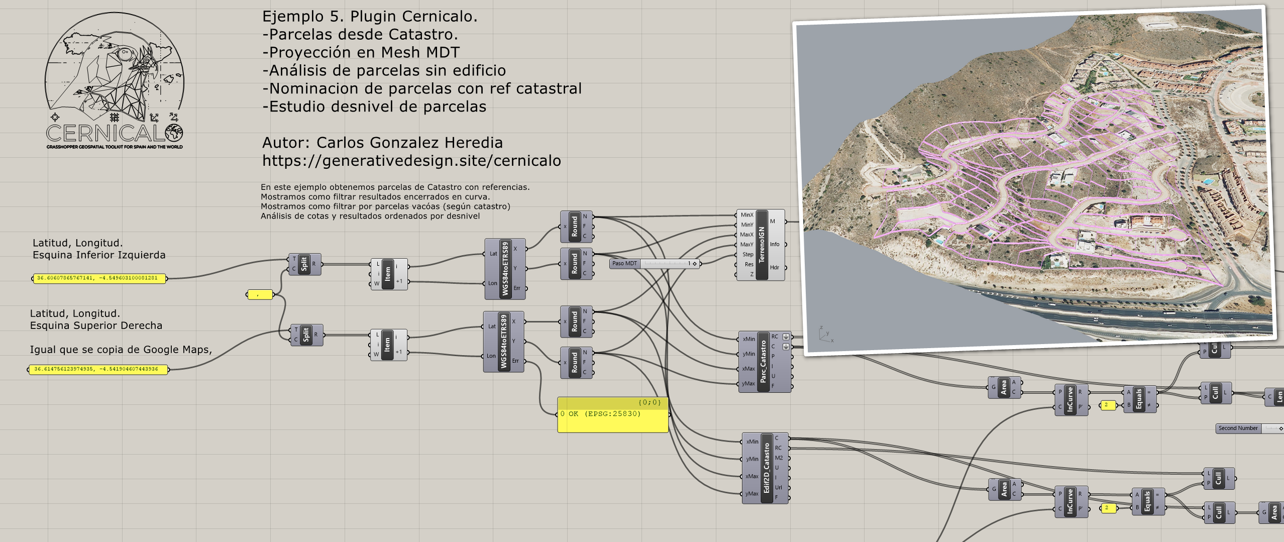
Parc_Catastro — Downloads cp:cadastralparcel and returns cadastral reference + outline + centre.
Edificios3D_GML — Reads a local INSPIRE .gml and builds Breps by storeys + summary.
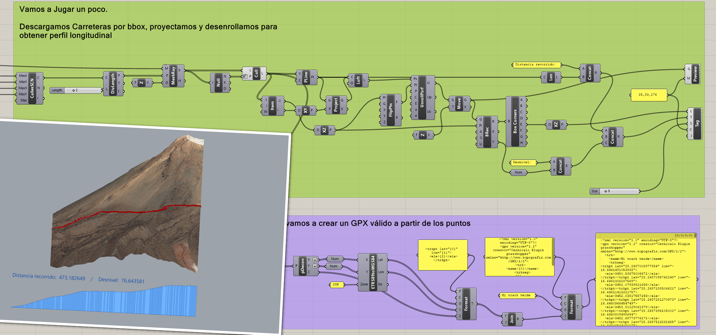
CallesSCN — Downloads tn-ro:RoadLink and returns polylines in EPSG:25830.
🌍 Global Datasets — Copernicus, Sentinel, OSM, Google, ArcGIS
GLO30 — Downloads a GLO-30 tile from Copernicus, crops it in WGS84 and builds a mesh.
EarthOrto — Queries Earth Search (Sentinel-2), downloads the visual asset (COG), crops to the WGS84 bbox and builds a textured mesh.
OsmBuildings — Queries the Overpass API for buildings and reprojects to ETRS89/UTM30N.
GoogleOrto — Downloads a Google orthophoto (tiles), builds a georeferenced mesh and exports a temporary GeoTIFF.
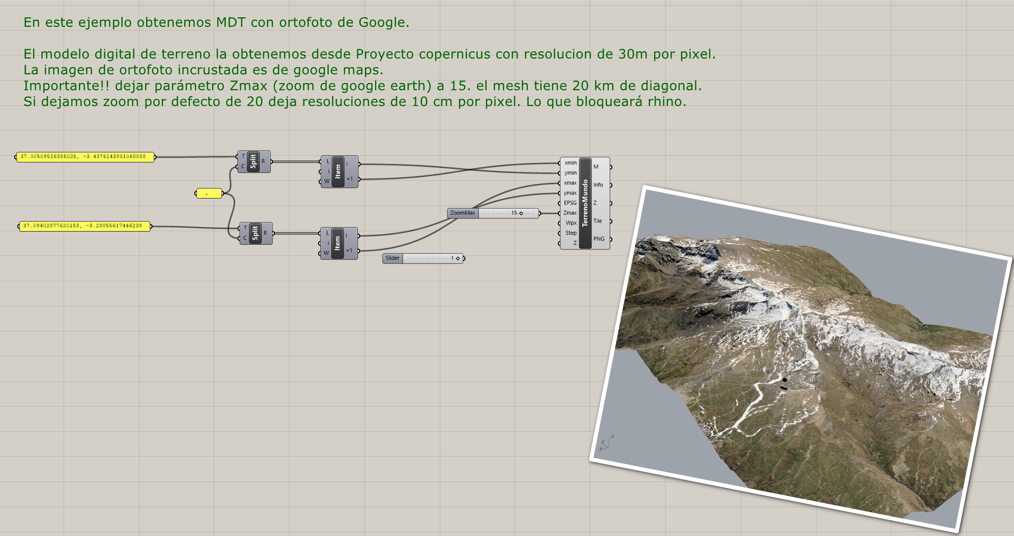
TerrenoMundo — Combines GLO30 DTM + Google orthophoto into a coloured 3D mesh.
arcgis — Builds meshes/curves from ArcGIS Online services (World Imagery, Topo, Transportation, Hillshade).
🧭 Geodesy — Transforms between WGS84 and ETRS89/UTM
WGS84toETRS89 — Converts WGS84 lat/lon to ETRS89/UTM with zone detection.
ETRS89toWGS84 — Converts projected coordinates (Easting, Northing) to WGS84.
🛠️ Utilities — Metadata and GDAL environment
CernicaloInfo — Assembly metadata: name, author, description, version.
GdalEnvironment — GDAL/PROJ initialization and configuration.
📋 Summary
Open-source Grasshopper plugin that uses the GDAL engine to convert geographic coordinates, download elevation data (CNIG, IGN, GLO30) and orthophotos, and automatically generate textured 3D terrain meshes. It integrates download, transformation and modeling into a unified parametric workflow.